Measurement and mapping at the burial ground
In 2023, we implemented a new system at Alne Wood Park for record keeping and mapping.
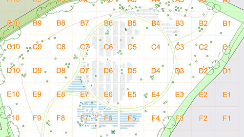
Mapping the burial ground
The new system connects an industry-leading cemetery database with a digital map. To create the map, the site was re-surveyed to record all existing burial locations using high resolution geo-location equipment. This data was synced with the original survey and Ordnance Survey data. All the records were imported into the record keeping software and checked against the original paperwork, and these records were then linked to the map.
You can see an online version of the map here - Map of Alne Wood Park Natural Burial Ground.
The map also acts as our public burial register which we are mandated to maintain as part of running a burial ground. You can search by name to locate a burial location on the map or click on individual plots to get the correct information. Pre-purchased are also indicated if the plot is clicked on, to show that they have been reserved but will not display a full name.
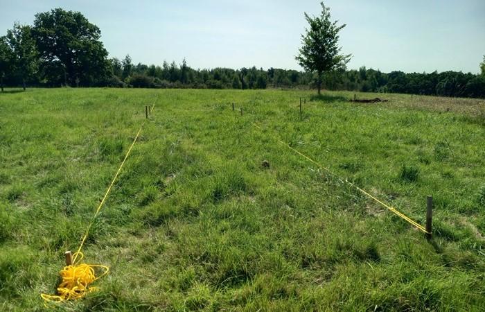
To ensure the digital data can be accurately matched to a physical position on the site, a grid of permanent survey markers have been installed. These are sunk into the ground at regular intervals across the whole of Alne Wood Park and can be used as points to measure from to accurately mark out plot locations. You may notice one of these markers in the middle of the track as you walk up the hill, it is a small aluminium square with a plastic disk on the top.
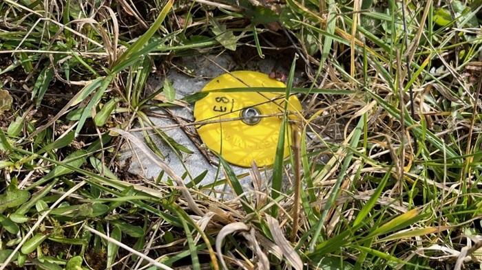
These markers are tricky to find in the grass, so if you see someone onsite using a metal detector, wearing a Heart of England Forest jacket, please come and say hello as it will be me trying to locate one of them.
Locating burial plots
In addition to the other mapping work, I have also recorded a what3words location for every burial site. what3words is a website and smart phone app that helps locate any position on earth within a 3-metre square. Each square is denoted by a 3-word key, for example the What3Words key for the gate at Alne Wood Park is: ///joints.gown.goes.
With the what3words app on a smart phone (which can be downloaded for free), it is possible to enter in a 3-word key and then for it to help you locate that. A GPS on a phone is not perfect, so typically it will get you within a 6-metre radius of the location but would provide great help to someone in finding the rough position of a burial plot onsite to help locate it.
If you are interested in the What3Words designation for a particular plot at Alne Wood Park, please get in touch and I will be happy to provide you with the information.