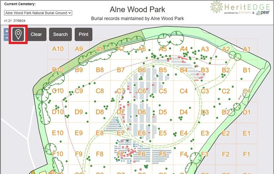
At Alne Wood Park we employ a dedicated software system to securely manage our burial records*, this is also linked to a publicly accessible, digital map of the site. This map provides the ability to see which plots are used, pre-reserved or currently available. It also allows the burial records to be displayed for plots where applicable.
This map can be accessed via a web-browser using this link: Alne Wood Park Online Map.
One benefit, is that it can be utilised by visitors to the burial ground to help locate graves. Specifically, you can display your current location while viewing the map on a smartphone to help navigate to a particular plot.
When onsite, to display your current location on the map, then select the map pin icon from the top left of the map interface (highlighted with the red square in the image below).

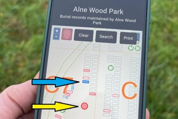
Selecting the map pin icon will display a red dot on the map which indicates your current location (highlighted by yellow arrow in image below). As you walk round the site the position will update allowing you to see where you are.
You can find the plot location you want to visit using the “Search” button – displayed at the top left of the map. A search can be conducted using a surname, forename or grave number/plot location, this will create a list of matching records. From this an individual plot can be selected, this will then highlight in blue (indicated by the blue arrow in image below).
The map will zoom in on the location and also display the record for that specific plot. if you zoom out until you can see both the plot location and the indicator for your position, you can now use it to help you walk to the correct location as our position on the map will update as you move.

Please note that the GPS function on a phone does have a margin of error of a few metres and weather conditions also affect this. In addition, to display your current location on the map you must have “Location” requests or permissions enabled for your web-browser on your smartphone.
* Burial grounds are required by law (Registration of Burials Act 1964 and subsequent amendments) to keep a register of all burials and make this information publicly available.

